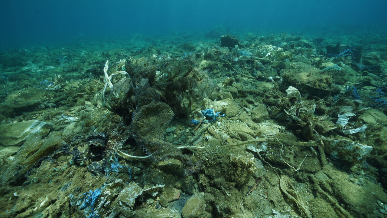
In 2019, our agency brought to media attention the existence of an underwater rubbish dump located off the coast of Andros, thus revealing this well-kept secret that had been hidden for eight years with immeasurable disastrous consequences affecting all of the Aegean which had never been documented. This continuous source of pollution has been feeding into the surrounding marine ecosystem.
Once we highlighted the issue, we proceeded to organise a large underwater clean-up of the affected area, which helped raise awareness of the matter. We then returned a third time to record and evaluate the extent of the damage and to assess the steps needed to tackle the issue on a larger scale. Images from these two initiatives travelled globally as numerous international news agencies covered the clean-ups.
Aegean Rebreath, from the very outset of their missions in Andros, emphasised that their main mission was to mobilize every relevant agency in order to find a solution to this shameful. Very soon, local agencies, as well as the Ministry of the Environment, approached our team wanting to contribute significantly to our efforts.
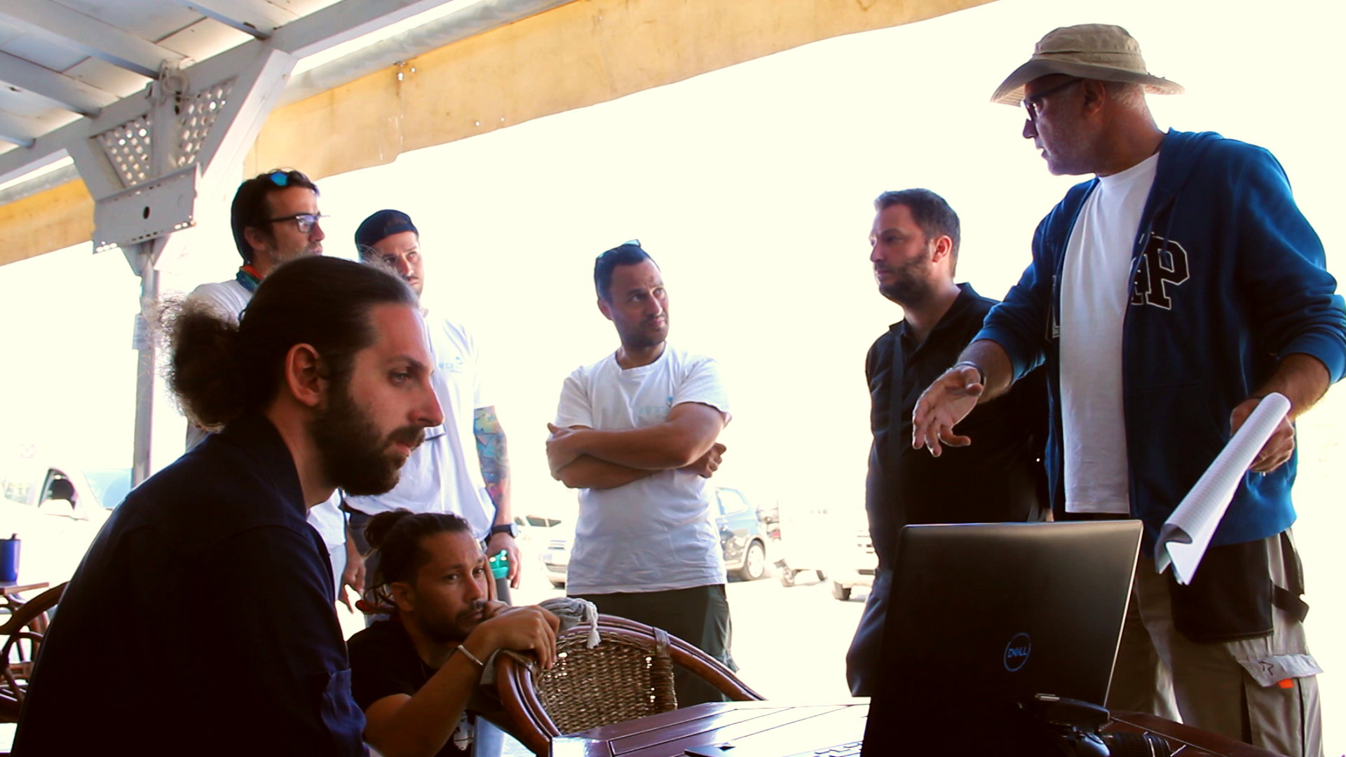
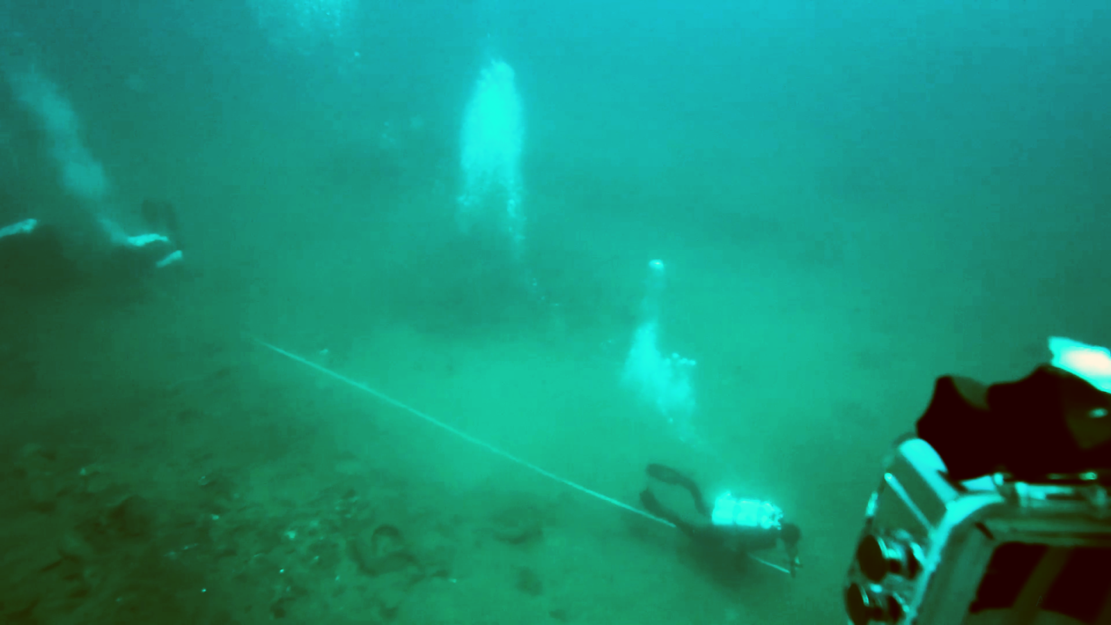
However, for the past four months, due to the harsh weather conditions and the outbreak of COVID-19, our team and partners, (Andros Maritime Association & ALS Marine Consultants), have been unable to continue to the second phase of this project. We were finally able to resume our efforts a few days ago, and we visited the island for a week’s work. This operation was particularly successful, as we managed to create a digital map of the immediately affected area, complete a volumetric measurement of the “plastic reefs” and retrieve samples for research purposes. The conclusions from this second phase will contribute to the environmental study which will help us determine the next steps necessary to remove this source of pollution from our seas.
.Unfortunately, the initial data collected shows that the extent of damage exceeds our initial prognosis. The damage extends over a 400-acre area while the collections of litter are found at depths of up to 100 metres. This data proves that a project on this scale has never yet been attempted across the globe.
In addition to our partners and the organisations that supported our efforts, we owe a big thank you to the individuals who responded immediately to our crowdfunding, allowing us to move forward with this project!